Before the town and mill were established the district was known as Onepu. Then in 1953, the New Zealand Geographic Board applied the name Kawerau to the new town and district.
Kawerau was a grandson of Toi Kai Rakau, who arrived in New Zealand about 1150 and from whom many of the present tribes of the Bay of Plenty claim descent.
Boundaries were defined when Tuwharetoa claimed the old Rangitaiki River boundary as its eastern border and Matata as its seaboard. Tuwharetoa's territory extended west along the coast to Otamarakau, southeast to Maungawhakamana and across to Putauaki.
When the sons of the ancestor Tuwharetoa moved from Kawerau to the Lake Taupo region, those who remained held fast to their ancestral name, which the two groups now share. Tuwharetoa ki Kawerau and Tuwharetoa ki te Tonga have, for geographic and other reasons, developed separately as important tribal entities but remain united in their genealogy.
There are several archaeological sites in the Kawerau district and indicate a large community occupied the area. A totara canoe covered by about 30cm of volcanic ash and 70cm of peat was found near the foot of Putauaki (Mt. Edgecumbe) suggesting a large pa existed on the site.
In the early 1930s Percy Fenton, a saw miller in the Bay of Plenty, acquired the cutting rights for 1500 acres of dense rimu bush at Te Haehaenga. The block was above the headwaters of the Tarawera River behind Lake Okataina. To set up the mill and associated facilities for its workers and their families, and to get the timber to market, Fenton had to build and maintain a 17.5km stretch of road, which included the strengthening of two bridges.
By 1935 New Zealand's economy was improving and things were looking up for the mill. The then- Whakatane County Council built a steel bridge across the Tarawera River near Waterhouse Street, to give better access to the area. It then extended the road from the Maori Affairs Block to the new bridge. Percy Fenton further extended the road to reach the mill. This became known as Fenton Mill Road.
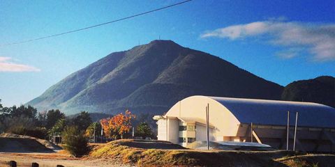
In the early 1950s, the government and the Fletcher Company were involved in planning a pulp and paper mill adjacent to Onepu on the banks of the Tarawera River. This led to the formation of the Tasman Pulp and Paper Company (now Norske Skog Tasman / Carter Holt Harvey Tasman) in 1952. The residential area ofthe town was laid out and buildings established under control ofthe Ministry of Works.
The Kawerau borough was officially created in April 1954 and managed by a government- appointed town commissioner. In November 1955, a public meeting elected eight people on to an advisory committee to support the commissioner. In 1968 this system was abolished and a Borough Council comprising a Mayor and 10 Councillors was formed. From then on, the normal borough administration proceeded in terms of the Municipal Corporations Act 1954.